
Why Ecotainment Uses Both the DJI M4T and the DJI M350-H30T for Professional Bat Surveys.
Why Ecotainment Uses Both the DJI M4T and the H30T for Professional Bat Surveys.
At Ecotainment we believe that every survey site is different, every project has its own challenges, and the equipment needs to be matched to the task.
That's why, at Ecotainment, we've invested in both the DJI M4T and the M350-H30T thermal drones. Having both payloads available allows us to deliver the highest quality survey data while remaining compliant with current industry guidance from the Bat Conservation Trust and adapting to the unique requirements of every project.
Choosing the Right Tool for the Job
Thermal imaging has transformed ecological surveying, providing surveyors with the ability to detect bats in low- light conditions while capturing high-quality evidence. However, thermal cameras are only effective when they are operated within their performance limits. Current Bat Conservation Trust (BCT) guidance stresses the importance of understanding the capabilities and limitations of thermal imaging equipment. Survey data must be collected at a resolution that is suitable for the survey objectives, ensuring the imagery remains fit for purpose. This is where the differences between our two drones become significant.
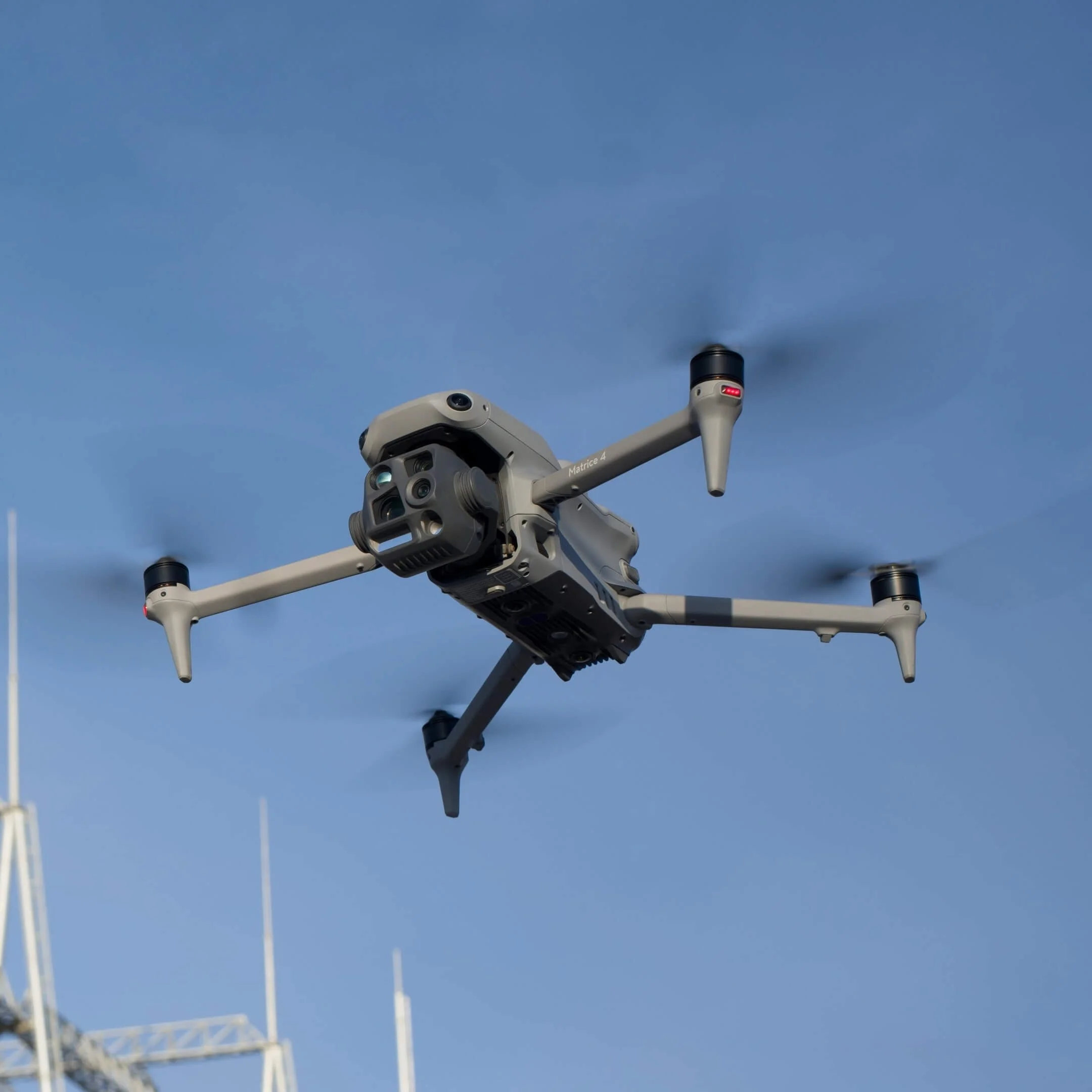
DJI M4T
The DJI M4T is extremely effective for many ecological surveys. For bat work, we operate the M4T at maximum survey distances of up to 74 metres. Beyond this distance, the thermal resolution no longer provides imagery of sufficient quality for reliable bat observations in line with current best practice.
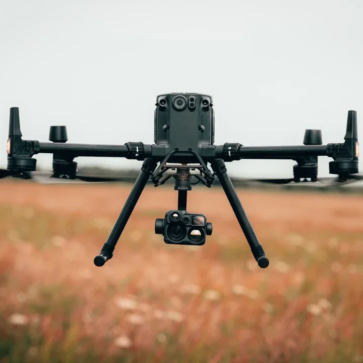
DJI M350 - H30T
For larger or more complex sites, the H30T offers a significant advantage. With an effective survey distance of 175 metres, the H30T enables Ecotainment to safely survey taller buildings, larger developments and wider landscapes while still collecting data that remains suitable for professional ecological assessment.
This increased stand-off distance can also reduce disturbance around sensitive habitats and allows survey teams to maintain safer operating positions.
Choosing the Right Tool for the Job
At Ecotainment, we believe that delivering high-quality bat surveys is about far more than owning a thermal drone it's about having the right equipment, the expertise to use it, and the ability to choose the best solution for every site.
Unlike many operators who rely on a single aircraft for every project, we have both the DJI M4T (x4 of these) and the H30T in our fleet. This allows us to select the most appropriate platform based on the size, complexity and specific requirements of each survey, whether it's a residential property, commercial development, church, bridge or large industrial site. By matching the technology to the survey requirement, we ensure the data we collect is fit for purpose and meets current industry best practice.
However, the aircraft themselves are only part of the equation. Successful bat surveys require an in-depth
understanding of bat ecology, thermal imaging, flight planning, survey methodology and the latest guidance. Our investment extends beyond the drones themselves, we continually develop our knowledge, skills and operational procedures to ensure every survey is carried out to the highest professional standard.
Having both industry-leading thermal platforms, combined with the expertise to deploy them effectively, means Ecotainment can provide a complete, flexible and professional bat survey solution. Whatever the challenge, we have the equipment, the experience and the know-how to deliver reliable results.
Working Alongside Industry Leaders
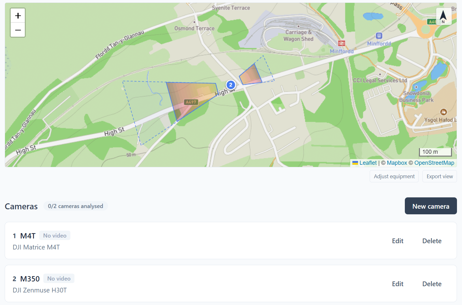
We also recognise the value of working with specialists across the sector. Organisations such as Night Arc have helped advance the use of thermal technology within ecological surveying, and we welcome the continued development of best practice across the industry. Using Night Arc to plan our flights allows us to assess and plan the location of each thermal payload, the suitable flight height, gimbal angle etc, prior to arriving at site. This ensures that each thermal drone is located within the requirements of the BCT, meaning our survey work would stand up to public inquiry.
Our Conclusion
At Ecotainment, we don't believe in a one-size-fits-all approach. We believe in using the right aircraft, at the right distance, with the right methodology, to produce survey data that is accurate, reliable and suitable for professional ecological reporting. By combining the DJI M4T, the H30T and the expertise of our experienced operators, we're able to provide clients with flexible, high-quality bat survey solutions that meet the demands of modern ecological consultancy.
Exceptional close-range thermal imagery
Compact and quick to deploy
Quieter for being closer to wildlife and habitats
Ideal for smaller buildings and structures
Excellent for detailed inspections
Cost-effective for many survey scenarios
Practical survey range of around 74 metres for professional bat work
Larger sites may require multiple flight positions
Reduced efficiency when surveying tall structures or large estates
Survey distances up to approximately 175 metres
Greater coverage from a single flight position
Ideal for large commercial buildings and infrastructure
Improved efficiency on extensive sites
Reduced repositioning during surveys
Better suited to complex or inaccessible locations
Larger aircraft requiring more operational planning
The drone produces more noise when flying
Greater capability than is necessary for some smaller projects