
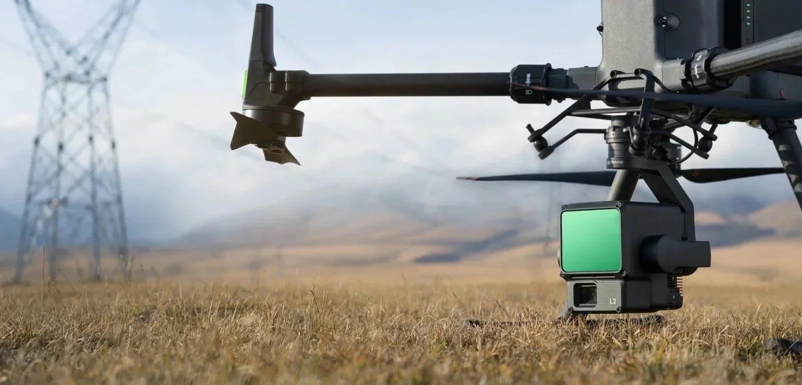
Drone LiDAR Mapping
Drone LiDAR is an advanced remote sensing technology that uses thousands of laser pulses every second to accurately measure distances to the ground and surrounding objects. These measurements are processed to create highly detailed 3D models, digital terrain models, and accurate survey data.
By combining a LiDAR scanner with an unmanned aerial vehicle (UAV), surveyors can capture precise data quickly, safely, and efficiently across large or difficult-to-access areas. Compared to traditional surveying methods, drone LiDAR significantly reduces field time while delivering exceptional accuracy and detail.
Drone LiDAR is widely used across a range of industries, including construction, engineering, agriculture, forestry, archaeology, environmental monitoring, infrastructure inspection, and urban planning. Its ability to penetrate vegetation and produce reliable terrain data makes it an invaluable solution for projects where accuracy and efficiency are essential.
Benefits of LiDAR Surveys
High-Precision Survey Data
Drone LiDAR delivers exceptionally accurate distance and elevation measurements, producing highly detailed 3D models and terrain data. This level of precision is ideal for topographic surveys, construction projects, infrastructure inspections, and engineering applications.
Penetrates Dense Vegetation
Unlike traditional surveying methods, LiDAR can penetrate dense vegetation to accurately capture the ground surface beneath tree canopies. This makes it invaluable for forestry, environmental assessments, flood modelling, and land management.
Detects Fine Details
LiDAR technology captures small features with outstanding clarity, making it ideal for identifying utility assets, structural defects, archaeological features, and other hard-to-see objects that may be missed using conventional aerial imagery.
Fast and Efficient Data Collection
Drone LiDAR surveys can cover large areas in a fraction of the time required for traditional ground surveys or manned aircraft, reducing project timescales, minimising disruption, and lowering overall costs.
Reliable in Challenging Conditions
LiDAR sensors are not dependent on sunlight, allowing surveys to be carried out in low-light conditions, at night, and in overcast weather. This flexibility helps keep projects on schedule, even when conditions are less than ideal.
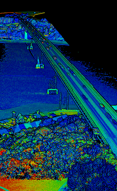
Industry Applications
-
Capture high-resolution terrain data to produce accurate topographic maps and digital elevation models (DEMs). Ideal for land development, engineering design, environmental assessments, and infrastructure planning.
-
Gain deeper insight into vegetation and forest health by analysing canopy structure, crop and tree height, biomass, and growth patterns. Enable more effective resource management, yield forecasting, and sustainable land use.
-
Streamline construction and infrastructure projects with precise as-built surveys, progress tracking, earthwork measurements, and volumetric analysis. Deliver reliable data that supports informed decision-making from planning through to project completion.
-
Monitor critical assets with detailed LiDAR data for vegetation clearance, transmission corridor planning, infrastructure inspections, and network management. Reduce operational risk while improving the resilience and performance of energy and infrastructure assets.
-
Improve operational efficiency with accurate stockpile measurements, cut-and-fill calculations, infrastructure mapping, stope monitoring, and pre- and post-extraction surveys. Access reliable spatial data to support safer and more productive mining operations.
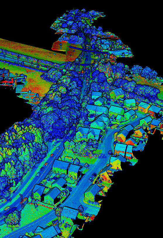
Case Studies
-
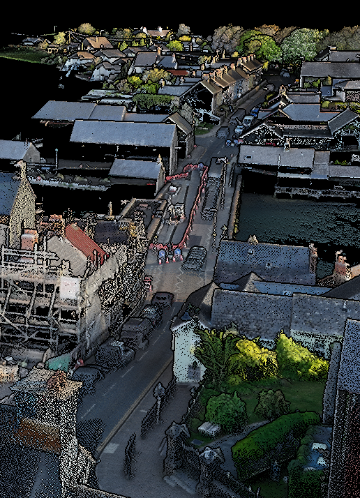
In conjunction with Ove Arup & Partners, National Grid commissioned Ecotainment Ltd to survey a 19 km road network in Pembrokeshire, Wales. The aim of the project was to capture high-resolution LiDAR data, in support of their transport and logistics planning. The primary objective was to provide accurate survey data for swept path analysis, ensuring large cable drum deliveries could be safely planned along the proposed route and through key access points.
To achieve this, Ecotainment divided the route into 37 individual drone flights, enabling complete coverage while maintaining the highest data quality. The collected data was processed into a high-resolution RGB LiDAR model, allowing National Grid to precisely measure road geometry, surface conditions, and surrounding infrastructure for detailed route assessments.
In addition to the main corridor survey, we captured detailed LiDAR datasets at (HDD) locations along the route. These datasets provide accurate 3D information to support engineering design, construction planning, and site logistics throughout the project. -
Ecotainment's drone survey team partnered with multidisciplinary specialists at Arup to capture a comprehensive aerial survey of the 33km Rassau to Brecon scheme for National Grid.
Using drone technology, we produced high-resolution 2D, 3D and LiDAR models covering the full length of the route. These models gave geotechnical, transport, project management and ecology teams a shared, accurate view of the site, helping to identify constraints early and inform decision-making across disciplines.
LiDAR data collected during the survey also played a key role in identifying suitable locations for HHD (horizontal directional drilling) compounds, supporting efficient planning of construction logistics along the corridor.