No access? no problem.
For ecologists, access restrictions can often be the biggest limitation on what we can observe. Large infrastructure and land management projects often cover vast areas, some of which are difficult, unsafe or simply impossible to access on foot. At Ecotainment, we use specialist ecology drone operators to bridge those gaps, particularly at the early stages of assessment.
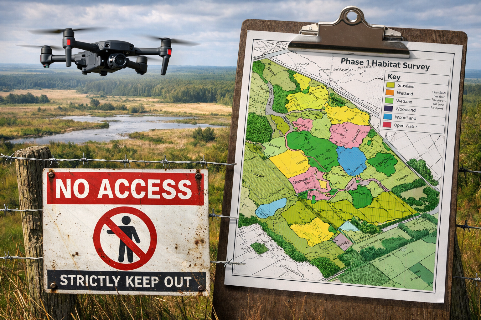
At the Phase 1 habitat survey stage, the aim is to understand the broad ecological picture and identify where more detailed work is needed. Drones can be especially useful here. They allow ourselves and our clients to gain an overview of habitat extent, identify boundaries and condition across large sites, helping to flag features of interest and focus ground surveys where they matter most. This reduces cost, time on site and limit unnecessary disturbance to sensitive areas and avoid biosecurity issues.
However, “no access” does not mean “no rules”. In the UK, overflying land is not the same as accessing it. You do not need a landowner’s permission to fly over their land. However, permission is required for where you take off and land.
The rules are:
Take-off and landing must be from land you have legal access to
The drone must be kept within visual line of sight, typically no more than 500 metres away
Maximum flight height is 120m above ground level
All flights must comply with CAA regulations, including registration and competency requirements
Wildlife legislation still applies, and flights must avoid disturbance, particularly during sensitive periods such as breeding seasons
If strategically positioned, your take off/landing position means you can fly 1km within minutes, creating a high resolution map of the area which can then by imported directly into GIS. Legal compliance is only part of responsible drone use. Wildlife legislation still applies, and disturbance can occur even without physical access, we recommend flying at 50m to avoid disturbance to breeding birds. Even at 50m, our drones are able to produce high resolution maps at 1.6cm GSD (ground sampling distance). In laymans, the resolution is around 15-18x more detailed than Google Earth. If you want to see an example, get in touch via Contact@ecotainment.co.uk.
Drones are not a replacement for field surveys or ecological judgement. Ground-truthing remains essential, particularly for Phase 1 surveys where habitat classification relies on subtle features that may not be visible from the air. Used well, however, drones can complement traditional methods, improve survey planning and reduce pressure on fragile habitats.
No access does not have to mean no data. For large-scale projects, drones offer a way to gather early-stage ecological information efficiently, legally and with minimal impact.
If you have any questions, do get in touch via contact@ecotainment.co.uk